Map Dots: Bread Crumbs to a Panorama of Geography
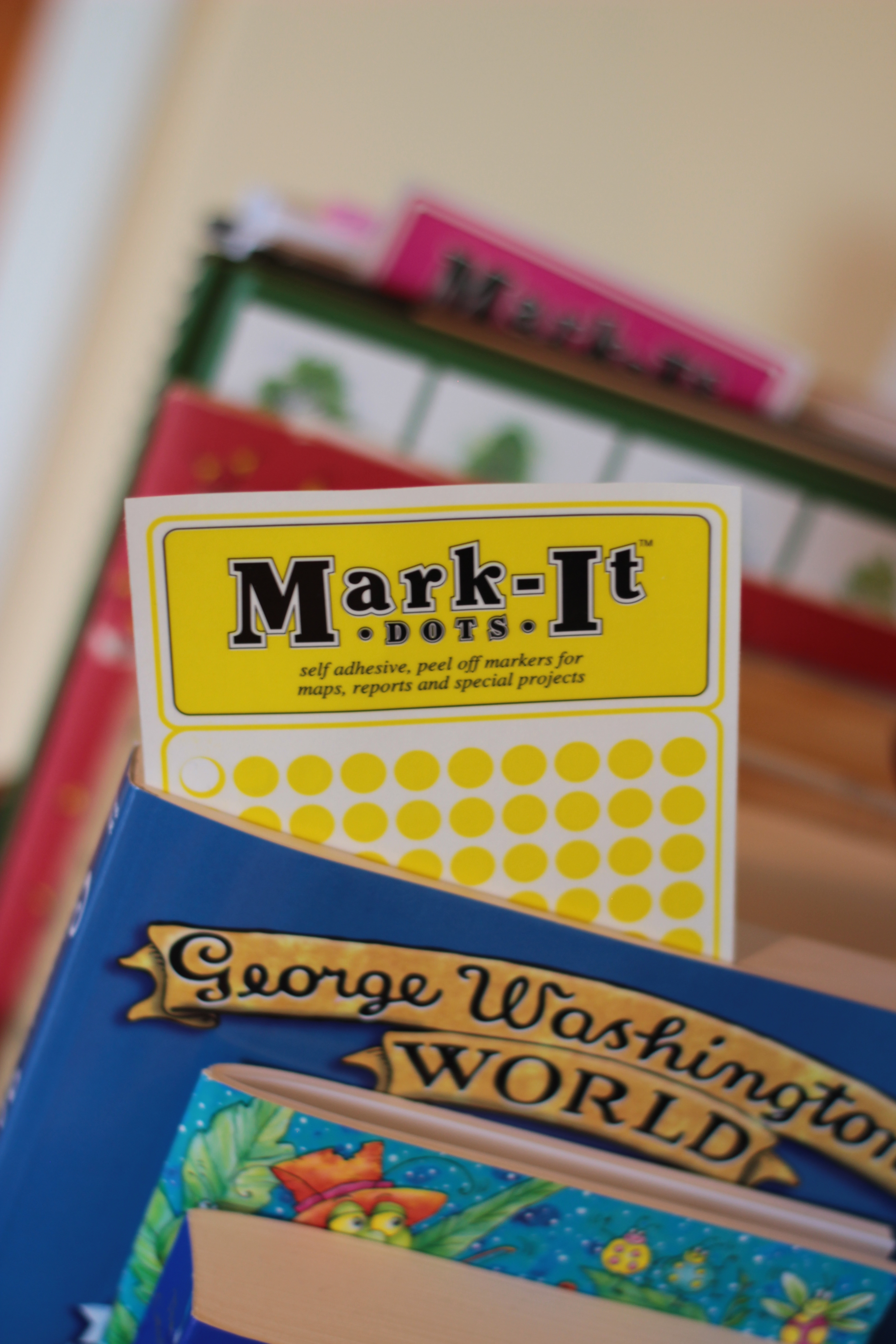
I hope you’re all enjoying the last bits of summer as we are! We started our lessons 3 weeks ago and a new year is underway again! I’ve been keeping up with all the little daily tasks and working on my own habit of attentiveness to my duties so posting has been sparse here lately, but I thought I’d break “radio silence” with a review of a simple and new-to-us tool that we started using last year that has been transforming my kids’ understanding of Geography: Mark-it dots for maps. The dots in this set come in one sheet each of: red, blue, green, orange, yellow, purple, pink.
I had been brainstorming ways to build geography literacy for the kids – and growing relationships with places and how they relate to…other places, and the people and events we were reading about. Charlotte Mason calls it a panorama that unfolds in an entrancing way:
“A map of the world must be a panorama to a child of pictures so entrancing that he would rather ponder them than go out to play; and nothing is more easy than to give him this joie de vivre. Let him see the world as we ourselves choose to see it when we travel; its cities and peoples, its mountains and rivers, and he will go away from his lesson with the piece of the world he has read about, be it county or country, sea or shore, as that of ‘a new room prepared for him, so much will he be magnified and delighted in it.’ ” (Volume 6, p. 42)
I asked myself if this “entrancing panorama” was possible? And…whatever conveyed this “panorama” – I needed it to be simple. And then I found these little map dots, and at the time, I didn’t know they would transform our connections in geography – I just thought they’d be a neat addition to our new maps. And after all, they peel right off, so no harm done, right? We’ve been using them for several months now, and I can start to see the deeper fruit that is waiting in these tiny little dots! They are very much like little bread crumbs from place to place, book to book, and the more we add, the more my children’s overall relationship with geography places deepens. As well as my own! The books the children are reading are rich and these little dots take their narrations and understanding that much farther – transforming our maps into this delightful panorama of places visited within the covers of our books…one little breadcrumb at a time.
The small sheets of stick-on dots are so handy for tucking right into a few of our different books. As you can see (above) we use yellow stickers in George Washington’s World (which we’re reading aloud as part of our Morning Basket readings this term). Different books have different colors and that helps distinguish them on our maps.
The concept is so simple! No need to plan this – no formatting, no follow up, no workbook page or quiz…just read your books, and when your child reads about a place, stick a map dot on your maps! Practically speaking, this happens in three different ways in my home:
- As I read a book aloud, the kids will instinctively jump up and say, “map dots” anytime I read of a particular place. My own visual understanding of the Ingalls’ family travels has deepened so greatly…just from following them using our map dots from Wisconsin to Kansas and then north to Minnesota. I mean…that’s a long way in a covered wagon sleeping under the stars!
- As a child reads, he places a dot on a geographical location after his reading which he then uses as a visual reference point for me as part of his narration. I LOVE this!
- As a child narrates, I might ask him if he/she knows where >>insert country, city, ocean here<< is – and together, we locate the place and stick a map dot there.
I think the simplicity is what allows this little trail of geography stick-on bread crumbs to flourish…because if it isn’t simple, it probably isn’t getting done here!
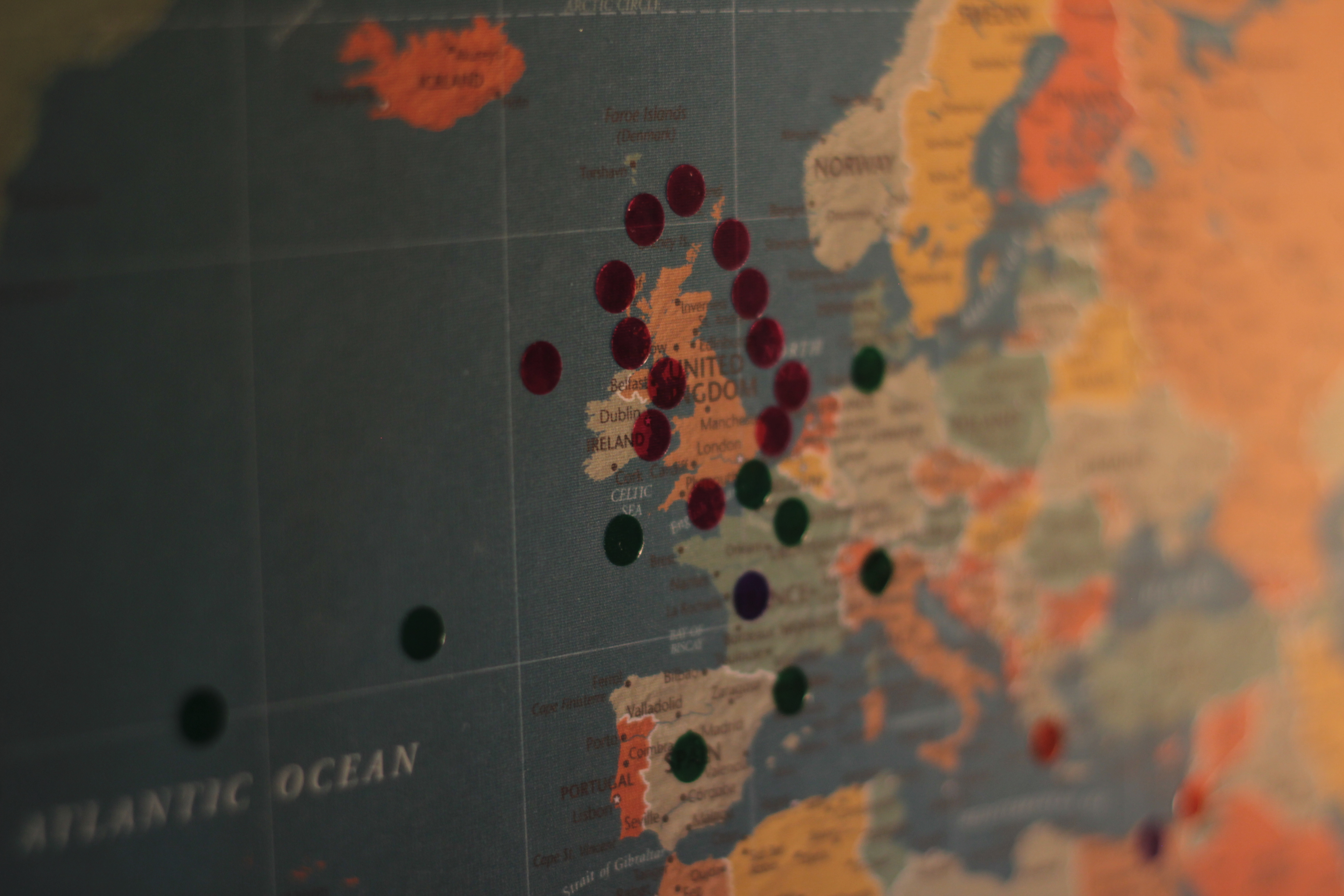
We use map dots on our world map and our US map. Above is a great example of map dots from different books. The pink dots are encircling Great Britain which my 2nd grader is reading about in Our Island Story. The green dots follow Richard Halliburton’s adventures in my 9th grader’s book, The Royal Road to Romance
. There is a random blue dot in there that was placed on there from my 5th graders reading of This Country of Ours
as he read about delegates traveling to France.
These geography “bread crumbs” begin to connect and overlap and the kids see the places they’re reading about, how close or how far apart they are, how they’re all related. It’s all about those relationships, as Charlotte Mason would say.
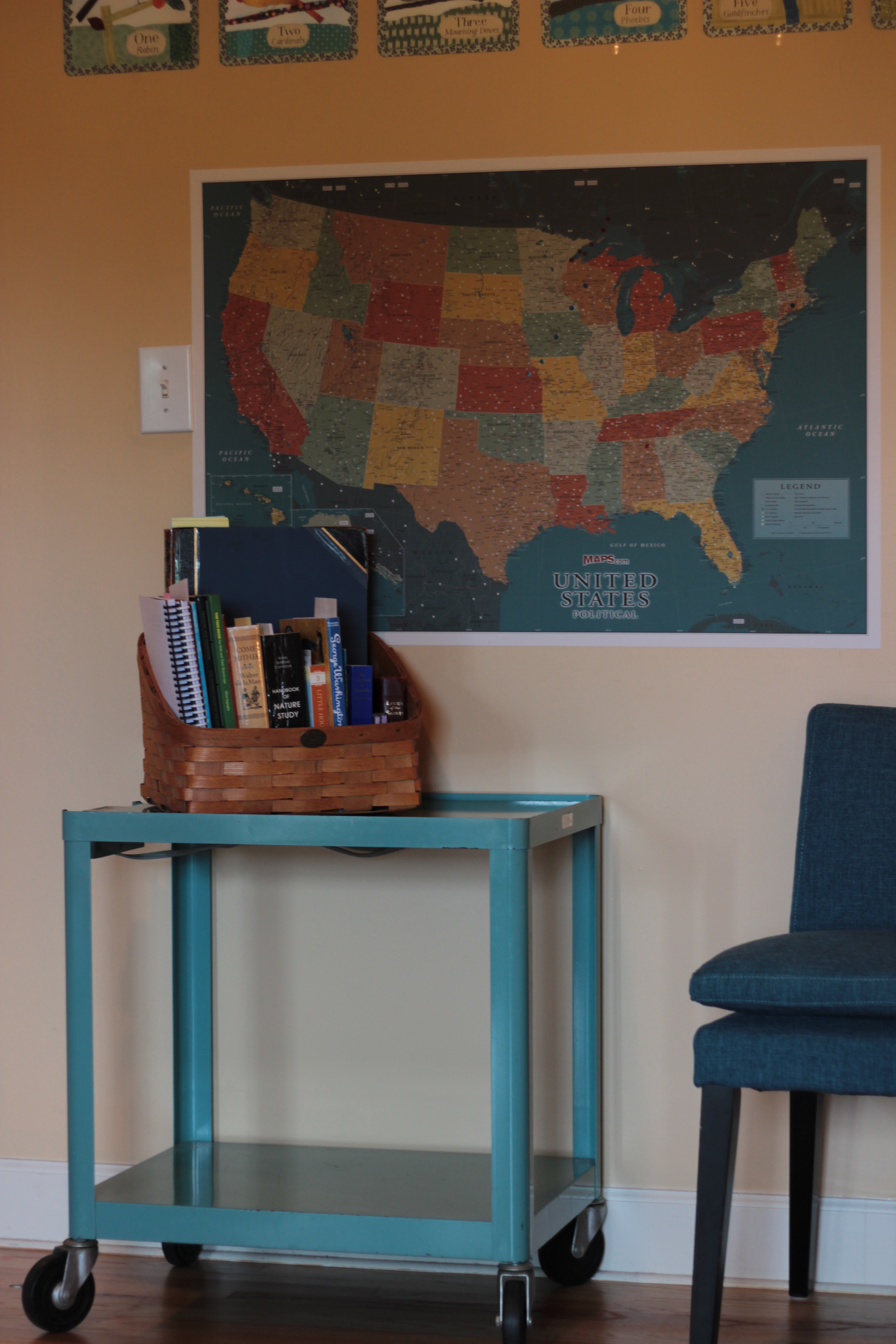
That’s a sneak peek of this term’s Morning Basket there on my little blue rolling cart! (you can read all about the Morning Basket plans for this term – right here!) Above, on the US map, we’ve dotted the travels of the Ingalls family since we’re reading the Little House on the Prairie series as part of our Morning Basket this year (I highly recommend the books with full color illustrations!). These dots literally leave little geography bread crumbs and the more we see “dotted” on our maps, the more connections and relationships my kids form with places and the events that they are reading about.
If you look closely at the books in the Morning Basket you’ll see the little bits of paper sticking up out of a few books (maybe they look like bookmarks) – those are simply the little map dots sheets, tucked in books, awaiting a new story, and a new place for a new geography bread crumb to be dropped!
If you’re curious about my maps (which I absolutely love!) you can read more about them and where I got them on this post on our Learning Room. They are printed canvas maps I purchased from maps.com that stick on the walls with re-positionable sticky (doesn’t harm the walls).
I’ll be back soon with our Morning Basket plans and our yearly plans and books! Until then…if you’re considering ways to enrich the unfolding panorama of geography in your home – consider map dots!


Very excited about these! Simple yet effective and just what we need!
Love this idea! also if you are after another map idea we love making mega maps, taping architect plans together, using the back
http://www.yourchildlearns.com/megamaps.htm
written about it a few times on my blog.
and drooling over your cart
I so enjoyed reading your blog post yesterday! I am always blessed by your words and have missed your posts for some time.. I remember reading about your maps quite a while ago and love this new idea you’ve shared. We’ve pointed out places on the globe over the years, but I truly think the dots on maps will make a lasting impression in comparison. I’ve added maps and map dots to my purchase list for this fall.
Be blessed!
Becca
Love this idea! Your link doesn’t seem to work for me, but it looks like you chose the 1/4-inch transparent dots — is that right? On another note, I met your friend Diana at the AO Retreat in IN this summer — talk about kindred spirits (we knew we’d hit it off when we realized we had YOU in common)! Thanks for all you’ve contributed to my family’s life and learning over the years, Jen!
I think it’s so great that you got to meet Diana, The AO conference sounded just wonderful! I’m so hopeful my schedule will allow me to attend one year soon!
And thanks for letting me know about the links being broken. Ugh. I went in and fixed them all – but yes, we have the ¼” transparent dots. I like them transparent so that we can still read city/river names through the dot.
Oh Jen, I always enjoy your posts. Please tell us where you got the blue rolling cart! Love!
Thank you so much, Mary! The blue cart — I just LOVE it, too!! You’re NOT going to believe it when I tell you where it came from: the dumpster! LOL!!! Yep! It’s true! My dad rescued it from a dumpster and my mom loaned it to me this past spring to do some bookshelf/library/homeschool planning work. Well that little cart proved itself to be so amazingly useful! I use it daily – DAILY – rolling it around as a little mobile desk. My oldest son rolls it around during the day, too, and uses it as his desk. As a result of its complete usefulness, Mom said we could keep the little cart. 🙂
It is an old academic cart – the label says “Pixmobile AV-445” and I did a quick google search with those terms and several academic surplus sales came up with the same blue cart. Check your local Craigslist or check academic surplus sales (because that’s exactly where this cart came from – a dumpster behind the liberal arts college where my dad teaches).
Hello Jen, Been lurking for ages and love every post. BUT, this time I just HAD to comment regarding these map dots. Oh my goodness! I LOVE this and WILL be incorporating this super idea! Thanks for being one of my favourite CM go-to-gals!
By the way, the “random” blue dot you have on France is covering the area of France we live in!
Thank you so much, Kim! And it’s amazing that we map-dotted right over where you live!
Wow! What a clever idea! We have loved having a big laminated map up to help us track things we read and we regularly jump up and point out locations on the map but having all the things we have studied stay there so we can see them as we progress and how they relate to each other is so very clever! I will be copying!